
Geodesy and Geoinformatics Bachelor of Science (B.Sc.)
Degree: Bachelor of Science (B.Sc.)
Regular program length: 6 semester (full-time program)
Credit points (ECTS): 180 credit points
Language of instruction: German
Higher semester: no
Higher semester: winter and summer term
First semester: September 15
Higher semester: September 15 for winter term, March 15 for summer term
First semester: July 15
Higher semester: July 15 for winter term, January 15 for summer term
Studiengangsbeschreibung
Worum geht’s?
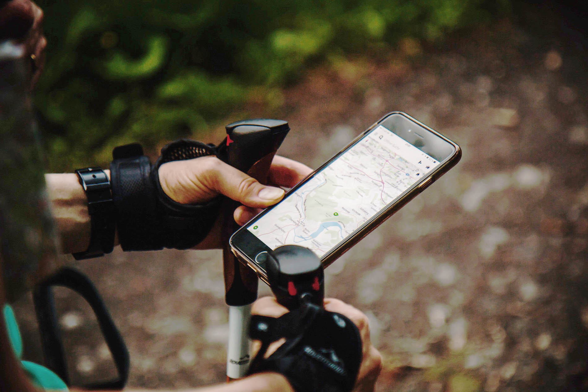
Im Studiengang Geodäsie und Geoinformatik beschäftigst du dich mit der Vermessung der Welt – genauer gesagt mit modernen Methoden und Instrumenten der Erhebung, aber auch der Qualität raumbezogener Daten und deren Abbildung. GPS, Augmented Reality, Maschinensehen, Künstliche Intelligenz und vieles mehr - in einem ausgewogenen Theorie-Praxis-Verhältnis vermittelt dir das Bachelorstudium das Handwerkszeug, um in vielen Bereichen beruflich einzusteigen oder ein Masterstudium anzuschließen.
Geodisziplinen wie Geodäsie und Geoinformatik zählen zu den wichtigen Zukunftstechnologien und tragen schon heute durch die gewonnenen Daten zu politischen oder wirtschaftlichen Entscheidungen grundlegend bei. Für einen nachhaltigen Umgang mit den Ressourcen der Erde und die Analyse von Naturereignissen wie Vulkanausbrüchen, Erdbeben und Massenbewegungen ist das Heranziehen von Geoinformationen unumgänglich.
Geodäsie bildet dabei die Basis: Sie macht es möglich, die Erde präzise zu vermessen – vom einzelnen Grundstück bis zu ganzen Kontinenten. Dafür kommen moderne Satellitentechnik, Sensoren und digitale Karten zum Einsatz.
Die Geoinformatik sorgt dafür, dass die riesigen Datenmengen, die dabei entstehen, digital verarbeitet, verknüpft und visualisiert werden – oft in 2D oder 3D und mit Hilfe künstlicher Intelligenz. So entstehen digitale Abbilder der realen Welt, die z. B. für Stadtplanung, Katastrophenschutz oder Verkehrsmanagement genutzt werden. Auch webbasierte Karten- und Informationssysteme sind Teil davon.
Du solltest gute Kenntnisse in Mathematik mitbringen und Interesse an der Gewinnung und Verarbeitung von Daten – also Informatik – haben.
Program structure
During your studies, you have various subjects, which consist of one or more modules. A module deals with a specific topic and consists of one or more courses. In the module handbook for your degree program, you will find a description of the modules and their subject assignment as well as a study plan. This gives you an orientation as to which courses you should attend in which semester in order to complete your studies within the standard period of study. It takes into account a balanced distribution of courses over the individual semesters. It also ensures that you are first taught the important basics before moving on to more advanced topics. Your individual course of study may differ from this.
Im Studiengang Geodäsie und Geoinformatik besteht dein Studienplan aus diesen Fächern:
- Mathematisch-Physikalische Grundlagen: Experimentalphysik, Differentialgeometrie und Mathematik vermitteln dir die notwendigen naturwissenschaftlichen Grundlagen.
- IT und Geoinformatik: Du lernst Wesentliches über Informatik und Datenverarbeitung, Datenbanken und konkrete Anwendungen der Geoinformatik.
- Vermessungskunde und Geodätische Sensorik: Du erarbeitest dir die Grundlagen des Vermessungswesens und führst eigene Messungen durch. Außerdem lernst du die relevantesten Sensoren und ihre situationsspezifische Anwendung kennen.
- Photogrammetrie, Fernerkundung und Computer Vision: Hier geht es um die dreidimensionale Erfassung von Koordinaten aus Bildern.
- Geodätische Referenzsysteme und Raumverfahren: Du lernst beispielsweise die Funktionsweisen von Satellitenmethoden oder eines Gravimeters kennen und führst eigene Messungen durch.
- Kartographie und Landmanagement: Hier geht es unter anderem um Rechtsgrundlagen der amtlichen Vermessung, aber auch der Immobilienwirtschaft und Bodenpolitik.
Stays abroad
KIT offers a wide range of options for stays abroad, from individual courses to a year abroad. Especially if you are interested in a longer stay abroad, it is advisable to contact the International Students Office early on.
Der deutsch-französische Doppelstudiengang „Geodäsie und Geoinformatik/Topographie“ wird am KIT in Kooperation mit der INSA Strasbourg angeboten. Der internationale Doppelstudiengang bietet dir die einmalige Möglichkeit, einen Auslandsaufenthalt von drei Semestern am Stück durchzuführen und neben dem deutschen Abschluss (Master) auch ein französisches Diplom zu erhalten. Der Ablauf ist hier wie folgt: Du besuchst das 1.–4. Semester im Bachelor-Studiengang „Geodäsie und Geoinformatik“ am KIT, anschließend studierst du im 5.–7. Semester an der INSA und die Semester 8 bis 11 verbringst du wieder im Master-Studiengang "Geodäsie und Geoinformatik" am KIT.
Bachelorarbeit
Am Ende deines Bachelorstudiums fertigst du deine Bachelorarbeit an, eine wissenschaftliche Arbeit, die es dir ermöglicht, dein erlangtes Wissen und deine Fähigkeiten anzuwenden und zu vertiefen. Normalerweise behandelt sie ein spezifisches Thema in deinem Studienfach und erfordert eigenständige Forschung, Analyse und das Verfassen einer schriftlichen Ausarbeitung. Die Bearbeitungsdauer der Bachelorarbeit beträgt sechs Monate.
Weitere Informationen
Außer dem Modulhandbuch ist unsere Studiengangbroschüre eine nützliche Informationsquelle. Sie behandelt auch Themen wie Bewerbungsverfahren, Studieneinstieg und Berufsperspektiven.
Qualification profile of the graduate
In the Bachelor's degree program, the scientific foundations and the methodology competence in the area of geodesy and geo-informatics are provided. The goal is to acquire the ability to successfully graduate in a Master's degree program, as well as to apply the acquired knowledge in professional areas.
The graduates of the Bachelor's degree program geodesy and geo-informatics have knowledge in the basics of processing and analysis of temporal and spatial data, as well as technical, methodical, and legal knowledge in geodesy and geo-informatics. Further, they have insight in most professional areas for geodesists. Based on their wide knowledge, they can name and describe advanced questions in geodesy and geo-informatics. They have well-founded knowledge about and methods for knowledge acquisition, in order to become acquainted with advanced questions.
They are able to independently analyze basic survey problems and implement practical solutions. They can implement algorithms of geo-informatics as well as apply essential methods for analyzing temporal and spatial data, as well as develop solutions for specific problems in their area of expertise. The graduates have the ability to collect simple relevant information, to analyze and evaluate it, and are able to become acquainted independently with simple topics and problems, as well as overview, analyze, interpret and evaluate them. They are able to work on a given concrete problem in a self-organized and solution oriented way. They can classify area-specific problems and choose suitable methods for acquiring measurement data, and for analyzing and evaluating them.
They know how to document, bring together, illustrate and interpret the obtained results. They are able, after an introduction, to work independently or in a team, to argue in area-related terms, and are able to discuss their arguments with and defend them in front of experts and lay people. The practical handling of specific knowledge occurs under consideration of societal, scientific and ethic aspects.
Berufsperspektiven
Mit einem Abschluss in Geodäsie und Geoinformatik hast du beste Chancen auf einen abwechslungsreichen und vielfältigen Arbeitsplatz. Der Mangel an Fachkräften ist in diesem Bereich aktuell groß. Typische Arbeitsbereiche sind
- Öffentliche Verwaltung
- Ingenieur- und Planungsbüros
- Selbstständige Tätigkeit als öffentlich bestellter Vermessungsingenieur oder Vermessungsingenieurin
- EDV-Dienstleistung
- Herstellung geodätischer Instrumente
- Automobilindustrie
- Automationstechnik
- Forschung und Lehre
Im Öffentlichen Dienst beschäftigen vor allem Behörden folgender Zuständigkeitsbereiche Spezialisten aus der Geodäsie und Geoinformatik:
- Landesvermessung
- Kommunale Vermessungs- und Versorgungsunternehmen
- Katasterwesen und Flurneuordnung
- Bundesamt für Kartographie und Geodäsie
- Straßenbau
- Wasser- und Schifffahrtsverwaltung
Um eine Anstellung im höheren vermessungstechnischen Verwaltungsdienst zu erreichen, musst du nach dem Masterabschluss einen 18-monatiger Vorbereitungsdienst (=Referendariat) absolvieren.
Tätigkeiten im Bereich der Ingenieurvermessung sind unter anderem:
- Planung und Leitung von Vermessungen im Gelände
- Durchführung von vermessungstechnischen Aufgaben bei der Planung, Absteckung, Überwachung und Rekonstruktion von Bauwerken (Verkehrswege, Brücken, Talsperren, Kraftwerke, Industrieanlagen, Wohn- und Gesellschaftsbauten)
- Mitarbeit bei Umweltverträglichkeitsprüfungen
- Vermessung von Grundstücken zur Sicherung des Grundeigentums
Auch der weiterhin stark expandierende IT-Bereich bietet dir Jobmöglichkeiten wie in der Softwareentwicklung und im GIS-Bereich. Im Vordergrund steht hier die Erfassung und Verwaltung raumbezogener Geodaten sowie die Erstellung und Nutzung von Geoinformationssystemen in den Bereichen Verwaltungs-, Verkehrs- und Versorgungsmanagement, bei Umwelt- und Sicherheitsaufgaben, bei Energieversorgern und Banken sowie für Freizeit und Tourismus.
Besonderheiten des Studiengangs
Besonderheiten von Geodäsie und Geoinformatik B.Sc. am KIT
- Interdisziplinäre Ausrichtung, insbesondere mit Anbindung an Informatik und Geowissenschaften
- Vorbereitungs- und Unterstützungskurse im MINT-Kolleg
- Kleiner, familiärer Studiengang - exzellente Studiensituation
- Hoher Praxisanteil (Übungen, Projektbearbeitung)
- Enger Kontakt zu Lehrenden und wissenschaftlichem Personal
- Lehre: Mitwirkung bei Forschungsvorhaben und Ingenieurprojekten
- Zugang zum deutsch-französischen Doppelabschluss (INSA Strasbourg)
- Fachbezogene Nebenjobs am Institut oder innerhalb der Uni
What KIT has to offer
- central campus close to the city forest and right next to the city center
- orientation week before the start of lectures
- 24-hour library offering single and group working places
- wide range of inexpensive catering options (dining hall, cafeteria, Koeri and Pizzawerk)
- numerous interdisciplinary offers for personal and professional development, e.g. Lernlabor, Schreiblabor and Perspektivenlabor
- study abroad, e.g. via Erasmus
- excellent university sports facilities with a large selection of sports
- comprehensive cultural offerings with university orchestras, choirs and theater groups
- extensive support for career entry and self-employment
- Lernraum app
- internationally oriented degree programs and diverse exchange programs
- modern laboratories and practical teaching methods
- diverse student initiatives, clubs and opportunities to actively participate in campus life
- stay in touch after graduation via the alumni network
Zugangsvoraussetzungen und Sprachnachweise
Higher education entrance qualification (HZB)
Germans and persons of equal status to Germans (i.e. EU/EEA nationals and non-EU/EEA nationals with a German higher education entrance qualification) are entitled to study at KIT if they have one of the following qualifications:
- General higher education entrance qualification (Abitur)
- (relevant) subject-restricted higher education entrance qualification (not Fachhochschulreife)
- Delta examination of the University of Mannheim (for holders of a Fachhochschulreife)
- recognized advanced vocational training (e.g. master craftsperson) or vocational training, professional experience and aptitude test for those with professional qualifications
For further options, see §58 of the "Landeshochschulgesetz" (State Higher Education Act).
Please note: German nationals with a foreign school-leaving qualification must have the relevant "Regierungspräsidium" (regional authority) certify that their qualification is equivalent to the German Abitur.
For non-EU/EEA nationals with a foreign school-leaving certificate (hereinafter also referred to simply as non-EU/EEA nationals), the school-leaving certificate from some countries is recognized as a direct university entrance qualification in Germany. In many cases, however, in addition to the school-leaving certificate, a university entrance examination and/or a successful year of study in the home country and/or the "Feststellungsprüfung" must be proven with valid documents in order to be allowed to study a bachelor's degree in Germany. You can find the country-specific regulations in the DAAD admissions database or on the Anabin website (in German only) of the "Zentralstelle für ausländisches Bildungswesen" (Central Office for Foreign Education). Further information is available from the International Students Office.
Sprachvoraussetzungen und -nachweise
Für den Bachelorstudiengang Geodäsie und Geoinformatik benötigst du ausreichende Kenntnisse der deutschen Sprache, welche mindestens dem Niveau C1 des Gemeinsamen Europäischen Referenzrahmens für Sprachen (GER) entsprechen.
Proof of sufficient German language skills
Your higher education entrance qualification (HZB) is sufficient proof of your German language skills,
-
if you obtained it at a German-speaking school in Germany or abroad,
-
if you are a graduate of a bilingual secondary school in Germany or abroad and have passed a bilingual German examination, such as the AbiBac or the Gemischtsprachiges International Baccalaureat (GIB) or
-
if you graduated from a foreign school, but there is another official agreement with the respective country on the recognition of your school-leaving certificate or language certificate as proof of language proficiency for university studies in Germany.
A complete list of foreign school-leaving qualifications and language certificates that are recognized as proof of sufficient German language skills can be found on the website of the Kultusministerkonferenz (Standing Conference of the Ministers of Education and Cultural Affairs of the Länder in the Federal Republic of Germany).
If you did not obtain your higher education entrance qualification at a German-speaking institution, you must provide a separate language certificate - regardless of your nationality. Only the following are accepted
- the passed „Prüfungsteil Deutsch“ of the Feststellungsprüfung,
- the passed DSH with the overall result DSH-2,
- the passed TestDaF level 4 in all four parts of the exam (reading comprehension, listening comprehension, written expression, oral expression) or
- a comparable, recognized certificate of sufficient German language skills.
To find out which other recognized certificates can be accepted as comparable by KIT, please contact
- as a German or German-equivalent applicant: Studierendenservice
- as an applicant with non-EU citizenship: International Students Office
Please note:
Language certificates are extremely important application documents that can prevent your enrollment if you do not submit them on time. Therefore, check early on in the application process whether you have the necessary language certificates for your degree program and, if necessary, plan to take one of the language tests mentioned above. The deadline by which you must submit language certificates corresponds to the enrollment deadline stated in your admission offer. In justified cases, you can apply for an extension of this deadline. The extension can be granted until the start of the lecture period at the latest.
Additional necessary requirements for enrollment
For Germans and those with German equivalent status, an additional necessary requirement for enrollment is proof of participation in a study orientation test (e.g. www.was-studiere-ich.de) or a study orientation consultation in accordance with §7 of the "Landeshochschulgesetz" (State Higher Education Act), e.g. by the Student Advisory Service (ZSB) of KIT. Non-EU/EEA nationals do not have to provide this proof.
Application portal
Application for the 1st semester
Application for a higher semester
Study preparation
Prepatory courses at KIT: The MINT-Kolleg offers prospective and first-year students support in natural science and technical subjects (STEM).
In addition, the KIT-Departments offer special preliminary courses before the start of the semester program during the "O-Phase" (orientation week).
Support during your start at KIT
The KIT offers support for all first-year students in order to have a successful start of their studies. Numerous orientation events and mentoring programs at the KIT-Departments help students to make friends, orientate themselves and find support where needed. The central online portalstudienstart.kit.edu is a first guide to all important offers, brings together all relevant information and contains helpful hints for a successful start of your studies:
- advisory centers
- mentoring programs
- info sessions
- workshops
- extensive online information
Contacts
Student advisor
Student advisory services (ZSB)
 +49 721 608 - 44930
 Annette Hildinger ∂does-not-exist.kit edu
Karlsruher Institut für Technologie (KIT)
Zentrale Studienberatung (ZSB)
Engelbert-Arnold-Str. 2
76131 Karlsruhe

Karlsruher Institut für Technologie (KIT)
Studierendenservice
Kaiserstr. 12
76131 Karlsruhe
First point of contact for international applicants

Karlsruher Institut für Technologie (KIT)
International Students Office (IStO)
Adenauerring 2
76131 Karlsruhe
Printed matter


Module handbook
Statutes and regulations
Teaching calendar
WT 2024/25
10-21-2024 to 02-15-2025
ST 2025
04-22-2025 to 08-02-2025
WT 2025/26
10-27-2025 to 02-21-2026
ST 2026
04-20-2026 to 08-01-2026
WT 2026/27
10-26-2026 to 02-20-2027
ST 2027
04-19-2027 to 07-31-2027
WT 2027/28
10-25-2027 to 02-19-2028
ST 2028
04-18-2028 to 07-29-2028
Lectures will not take place:
- From 12-24 to 01-06
- the week after Pentecost
- on all public holidays in the state of Baden-Wuerttemberg